Project Documents
Reports
Storm Babet Flood Event Report
Storm Babet Flood Event Report (Part 1)
Storm Babet Flood Event Report (Part 2)
Storm Babet Flood Event Report Appendices
Appendix A- Observed vs Modelled Flood Extent Maps
Hydraulics Report
Hydraulics Report Appendices
Appendix A.1 (Part 1 of 2)- Existing Scenario: Fluvial Flood Extent Maps
Appendix A.1 (Part 2 of 2)- Existing Scenario: Fluvial Flood Depth Maps
Appendix A.2- Existing Scenario: Tidal Flood Maps
Appendix A.3- Existing Scenario: Pluvial Flood Maps
Appendix A.4- Existing Scenario: Groundwater Flood Maps
Appendix A.5- Climate Change Scenario: Fluvial Flood Extent Maps
Appendix A.6- Climate Change Scenario: Tidal Flood Extent Maps
Appendix B- Hydraulic Model Results
Appendix E- Numerical Stability and Mass Balance Plot
Hydrology Report
Natural Flood Management Feasibility Report
Natural Flood Management Feasibility Report
Arbricultural Tree Survey Report
Arboricultural Tree Survey- Report & Appendix 1-4
Arboricultural Tree Survey- Appendix 5 (Part 1)
Arboricultural Tree Survey- Appendix 5 (Part 2)
Information Leaflets
Information Leaflet April 2021
Information Leaflet November 2017
Japanese Knotweed
Constraints Assessments
Summary Updates
Progress Update September 2021
Progress Update September 2020
Progress Update September 2019
Progress Update September 2018
Brochure
Posters
Board No. 01- Scheme Objectives and Overview
Board No. 02- Public Consultation Process
Board No. 04- Area 1 & 2 Constraints
Board No. 05- Area 1 & 2 Emerging Preferred Option
Board No. 06- Area 3 (North) Constraints
Board No. 07- Area 3 (North) Emerging Preferred Option
Board No. 08- Area 3 (South) Constraints
Board No. 09- Area 3 (South) Emerging Preferred Option
Board No. 10- Area 4 Constraints
Board No. 11- Area 4 Emerging Preferred Option
Board No. 12- Area 5 Constraints
Board No. 13- Area 5 Emerging Preferred Option
Board No. 14- Area 6 Upstream of Water Rock Cave System/ Underground Watercourse
Board No. 15- Ongoing and Potential Future Projects
Board No. 16- Natural Flood Management Feasibility Study
Board No. 17- Scheme Climate Change Adaptation Plan
Board No. 18- Baby's Walk Emerging Preferred Option (1 of 2)
Board No. 19- Baby's Walk Emerging Preferred Option (2 of 2)
Board No. 20- Flood Defence: Indicative Materials and Character
Board No. 21- Baby's Walk: Enhancing Heritage and Placemaking
Information Videos
Midleton FRS- Natural Flood Management
Midleton FRS- Scheme Climate Change Adaptation Plan
Summary Report
Brochure
Posters
Midleton FRS- Scheme Objectives and Overview
Midleton FRS- Public consultation process
Midleton FRS- Fluvial Flood Extents
Midleton FRS- Tidal Flood Extents
Midleton FRS- Pluvial Flood Extents
Midleton FRS- Preliminary Technical Assessment (1 of 2)
Midleton FRS- Preliminary Technical Assessment (2 of 2)
Midleton FRS- Area 1 Tir Cluain to Willowbank Options
Midleton FRS- Area 2 Northern Relief Rd- Cork Rd Bidge Opts
Midleton FRS- Area 3 Town Centre and Bailick Rd Option
Midleton FRS- Area 4 Lauriston and Rugby Club Options
Midleton FRS- Area 5 Ballinacurra Options
Midleton FRS- Area 6 Water Rock (inc Dwyers Rd) Option
Midleton FRS- Considerations of climate change
Midleton FRS- Potentenial Future Developments
Midleton FRS- Architectural Details (1 of 2)
Midleton FRS- Architectural Details (2 of 2)
Summary Report
Public Information Day No. 1 Documents
Public Participation Day No 1 Posters
Public Participation Day No 1 2015 Flood Event Extent
Public Participation Day No 1 Questionnaire
Presentation given at Municipal District Meeting in Midleton on 6th March 2017
Presentation Municipal District
Project Area
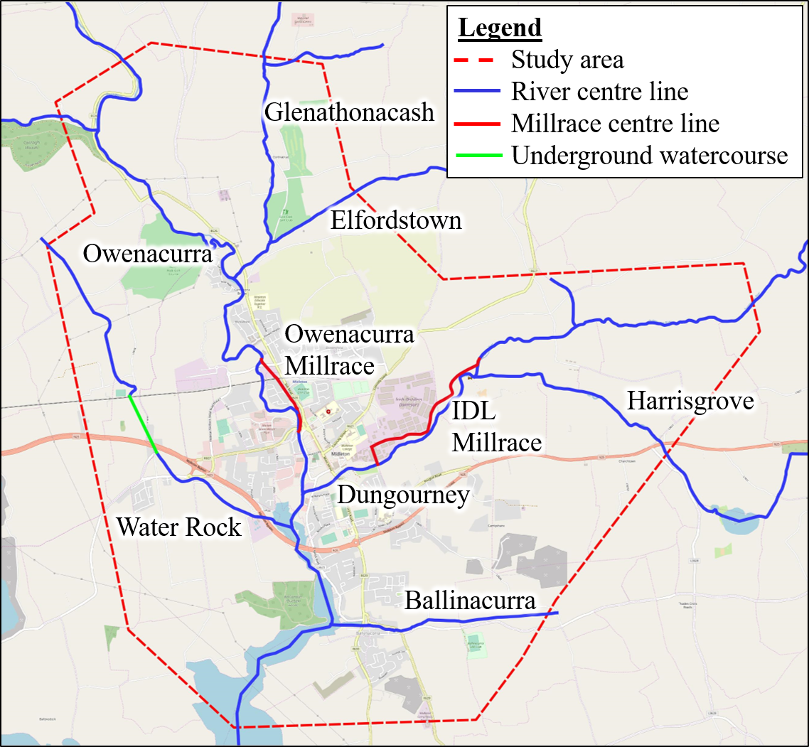
The study area consists of the Owenacurra and Dungourney Rivers and their tributaries
