Project Documents
Design Stage Progress Updates
Confirmation Documents
Exhibition Material - November 2016
Project Reports
Glashaboy River FRM Environmental Assessment Nov 2016
Public Information Day No. 2 Documents
Constraints Report
Glashaboy FRS Constraints Study_(1 of 2).pdf
Glashaboy FRS Constraints Study_(2 of 2).pdf
Public Information Day No. 1 Documents
Public Information Day No 1 Brochure
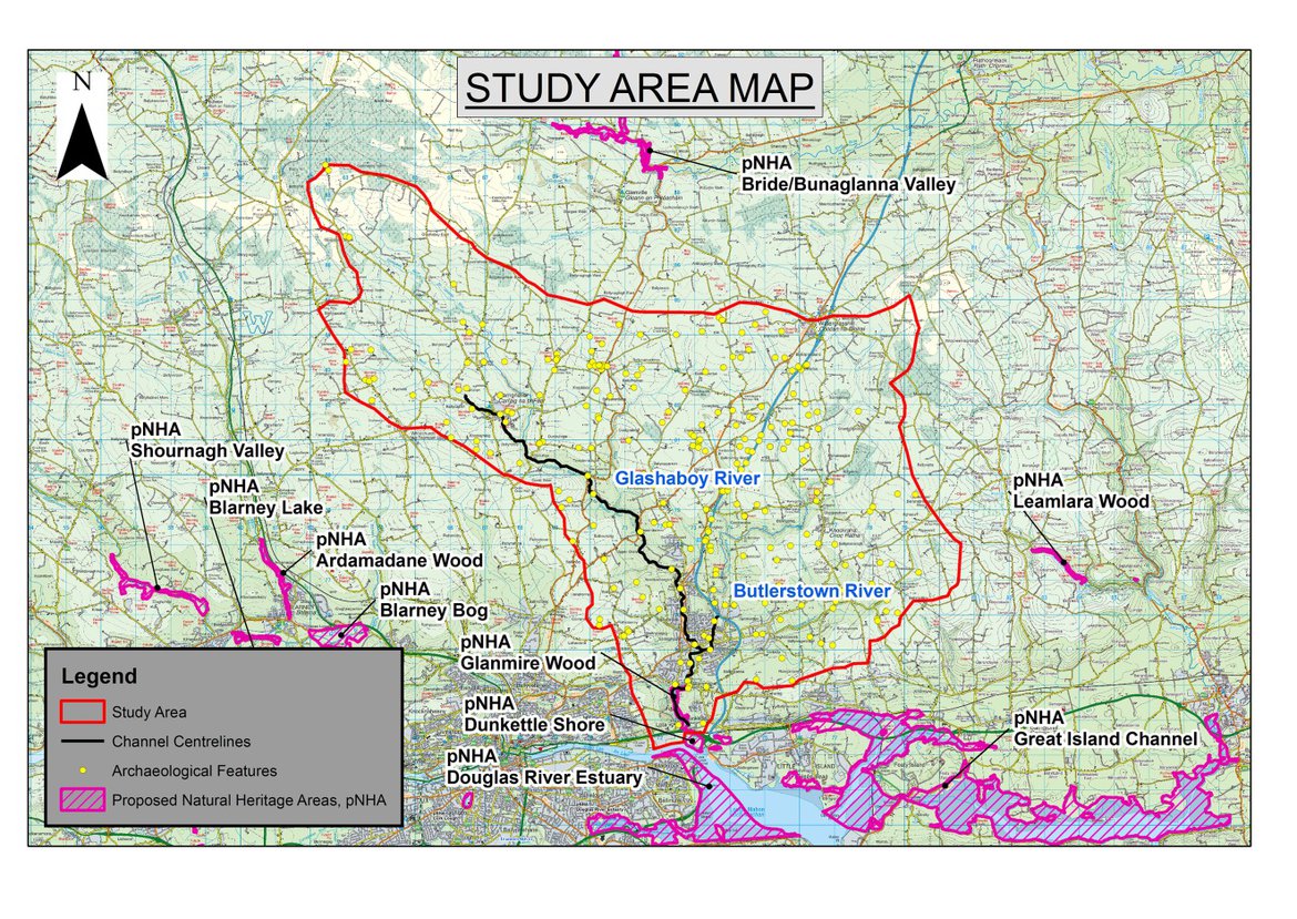
Study Area
The study area consists of:
The Glashaboy River and Estuary, and its tributaries including the Butlerstown River.
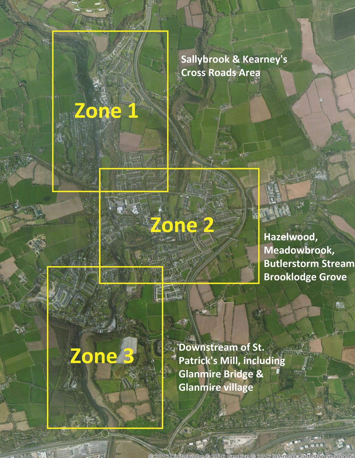
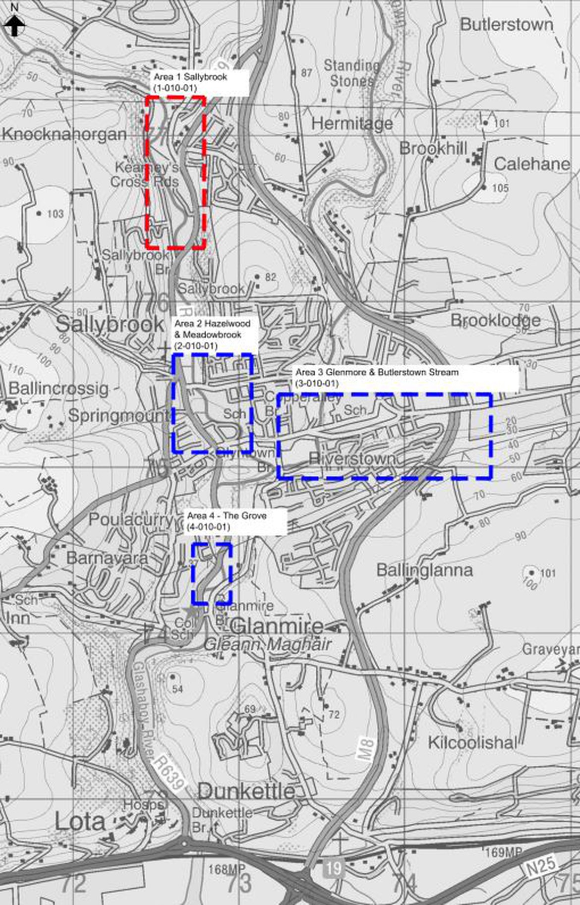
Zones
By clicking on a link below you will be brought to a new page with links to the drawings relevnt to that particular zone. (Plans, sections, floods extents, benefiting land, works & access areas and finishes)
Or alternatively you can download the complete set of Exhibition Drawings here: