Project Documents
Project Newsletter
Project Newsletter No. 1 (November 2021)
Project Newsletter No.2 (May 2022)
Project Newsletter No.3 (October 2022)
Project Newsletter No.4 (May 2023)
Project Newsletter No.5 (September 2023)
Project Newsletter No.6 (December 2023)
Project Newsletter No.7 (May 2024)
Project Newsletter No.8 (Dec 2024)
Project Reports
Project reports will be published here as they become available
Public Consultation Event #1 (18th November 2021 to 17th December 2021)
To view the posters displayed during this Opening Public Consultation Event please click here
Other Documents
Scheme Area Map
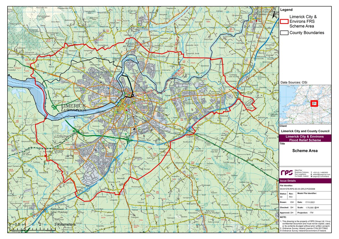
Project Area
The project area encompasses the City of Limerick and selected environs situated in both counties Limerick and Clare please refer to the map below.
The scheme area is broken into three subareas:
Subarea 1 – Annacotty (SA1)
Annacotty forms part of the overall scheme area but requires distinct treatment, consideration is being taken to progress Annacotty in parallel with the remainder of the scheme for faster delivery time.
Subarea 2 – Kings Island (SA2)
The Kings Island Flood Relief Scheme (KIFRS) is currently underway as a separate project to the Limerick City and Environs Flood Relief Scheme. Compatibility between the two schemes is required to ensure a better outcome for all stakeholders.
Subarea 3 – City Centre Public Realm
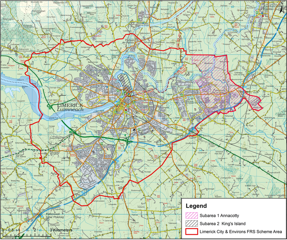
The development of public realm assets will form a major part of the scheme. It will aim to maximise opportunities for public space & landscape development, and improvements to the riverside adjacent to flood defences.
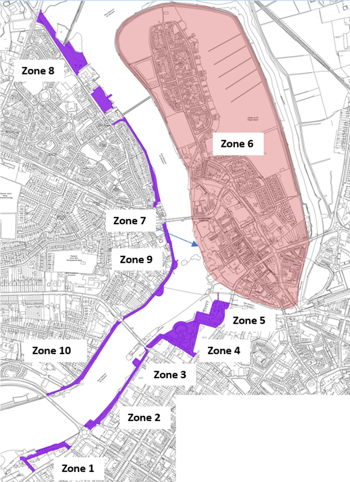
The City Centre Public Realm forms part of the overall scheme area and is broken into 10 zones:
Zone 1: Steamboat Quay
Zone 2: Shannon Bridge to Sarsfield Bridge
Zone 3: Honan’s Quay
Zone 4: Arthur’s Quay
Zone 5: Custom House Quay
Zone 7: King John’s Castle
Zone 8: Brown’s Quay / New Road
Zone 9: Clancy Strand
Zone 10: O’ Callaghan Strand
Each zone is shown on the map below.