Project Documents
Project Area
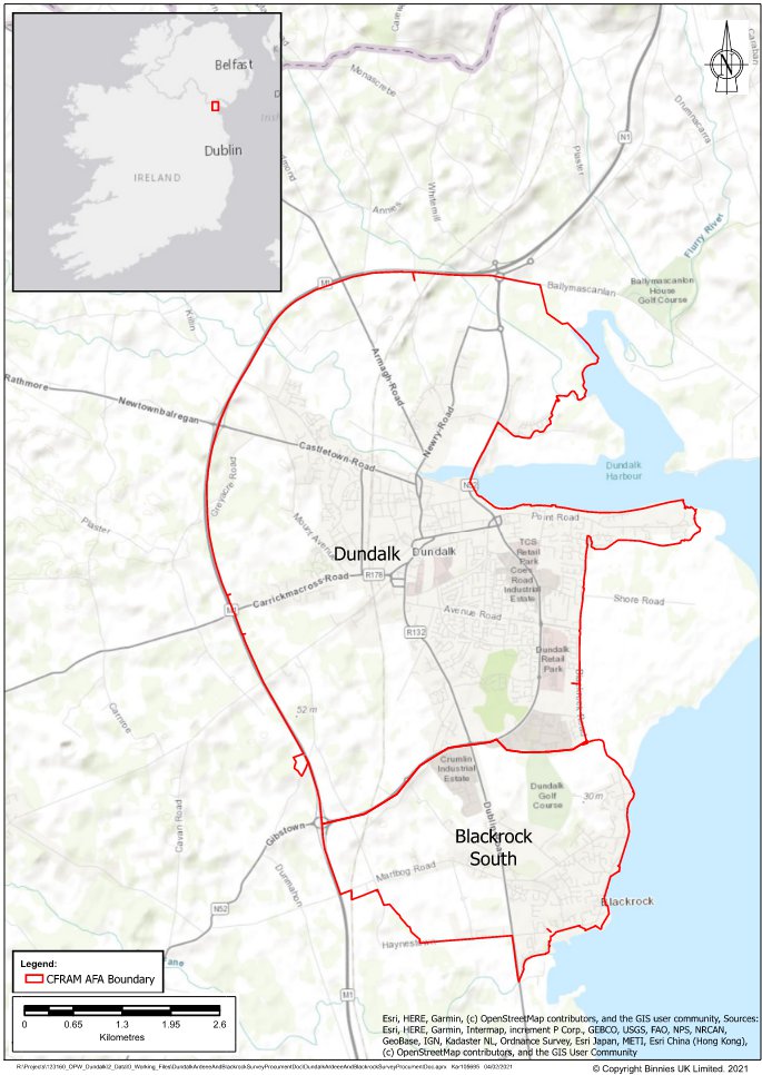
The focus of the Flood Relief Scheme is Dundalk/Blackrock which has been susceptible to past flooding in extreme events. These areas have also been identified as having a significant risk of flooding from future events. This will focus within the boundary of the Area for Further Assessment (AFA) as defined in the OPW’s CFRAM Study and shown on the maps below.
The Study Area is the area that contains the:
- Lengths of river channel / watercourse that have hydraulic influence on the area intended to benefit from, and be protected by, any feasible scheme;
- Full hydrological catchment areas draining to the downstream ends of those river channels / watercourses;
- Areas that require environmental assessments as part of the development of any such scheme.
The Scheme Area is the area:
- Within which physical works are proposed to be constructed, accessed and maintained as part of any feasible scheme;
- Areas that are intended to benefit from, and be protected by, any such scheme;
- Lengths of river channel / watercourse upstream and downstream that are likely to be impacted hydraulically by such scheme.
Greenway
Where possible, the scheme intends to capitalise upon the potential flood defences from Blackrock to Bellurgan as a potential corridor for a section of the Great Eastern Greenway from Belfast to Dublin. This presents an opportunity to provide a significant piece of infrastructure which has the potential for huge recreational, tourism and financial benefits for the area.
Neagh Bann CFRMP
Neagh Bann CFRMP (refer to page 75 for the Dundalk proposed flood relief measures which will be subject to further development as part of this project)
Hydrology
The Hydrology Report (prepared by the project team in 2022) aims to record the hydrological analysis work carried out to map out the flooding risk.
Environmental
The Environmental Constraints Study (prepared in 2022) presents an anlaysis of the environmental constraints within the project area, including any vulnerable environmental features, potential impacts of the flooding mitigation options and develops a clear approach to managing environmental risks through the project.
Several environmental surveys were carried out throughout the project, including:
- A Bird Survey in 2023-2024
- A Bat Survey in 2023
- A Baseline Aquatic Survey in 2022
- An Habitat and Invasive Non-Native Species Survey in 2022
- A Migratory Bird Survey in 2021
- A Wintering Bird Survey in the winter of 2020-2021.
Flood Risk Management Areas
Click here to see the Flood Risk Management Areas of Dundalk, (you will be redirected to Floodinfo.ie)