Project Documents
Public Exhibition Map
Coming soon!!
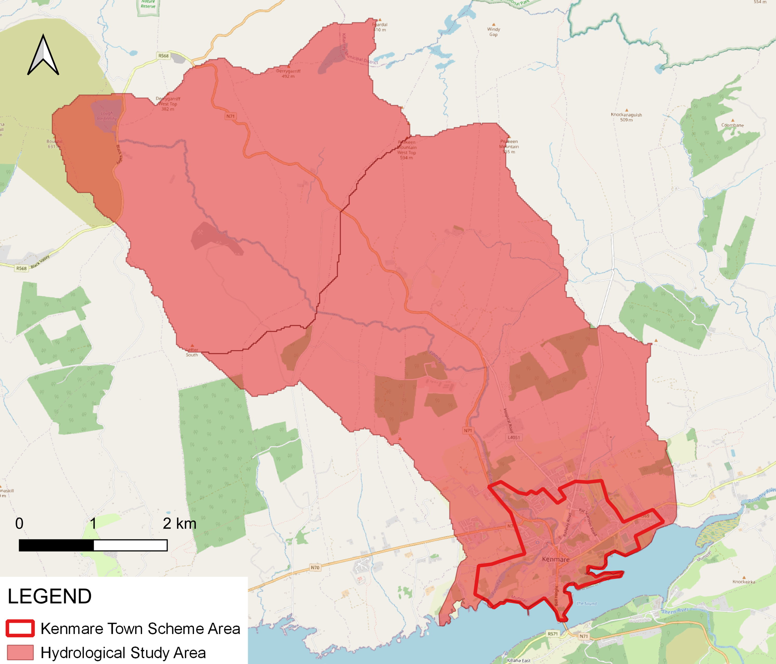
Project Area
The Study Area (Finnihy Subcatchment) encompasses the Town of Kenmare and environs and contains the:
- Lengths of river channel / watercourse/estuary that have hydraulic influence on the area intended to benefit from, and be protected by, any feasible scheme.
- Full hydrological catchment areas draining to the downstream ends of those river channels/watercourses.
- Areas that require environmental assessments as part of the development of the scheme.
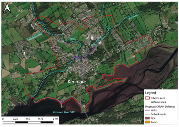
The Scheme Area is the area:
-
where physical works are proposed to be constructed, accessed and maintained as part of any feasible flood relief scheme;
-
that contains the lengths of river channel/ watercourse/ estuary that have hydraulic influence on the area intended to benefit from, and be protected by, any feasible scheme;
-
that is intended to be benefit from, and be protected by, any such scheme
The CFRAM studies identified flooding issues or potential flooding issues at a number of locations including Kenmare town square & centre, Creamery Road Car Park, Scarteen Park, Cill Mhuir Estate, Finnihy Banks & adjacent Housing Estate, an area along N71 North of Suspension Bridge, Kenmare Pier, an area along L7606 & L4055 and Gortamullen area at Kenmare Town.
This project will create a hydraulic model to simulate flood events, taking into account ground-truthing data gathered by the project team from site walkovers and surveys. The models will be used to run a range of different flooding scenarios and shall be used to determine what interventions will be required at locations where issues are identified.
Furthermore, the project team will incorporate observations made during historic flood events to ensure the flood mechanism, and associated flow paths, are accurately represented in the hydraulic model. Suitable mitigation measures will be assessed thereafter.
Issues affecting the scheme area such as tidal effects, groundwater issues, pluvial events, and sewer network issues will be considered and assessed to inform the development of the scheme.
Steering Group
The following organisations form the basis of the Steering Group for the Flood Relief Scheme. We will meet on a monthly basis to discuss the progress of the project and review technical challenges that we have come across or can see arising.