Introduction
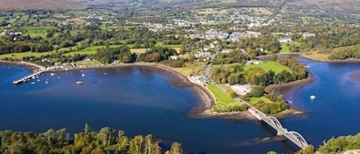
Kenmare is a busy market town situated at the mouth of the Kenmare River at the south-eastern extremity of the Iveragh Peninsula in County Kerry. It is located in an area of highly scenic landscapes with panoramic views of the Caha and Shehy mountain ranges to the south and the MacGillicuddy Reeks ranges to the north. Its dramatic coastal setting and mountain backdrop has made Kenmare an attractive tourist destination with Tourism being one of the primary drivers of the local economy in recent times. The historical development of the town, established in the late 1700’s has left a significant built heritage. The town centre is a designated Architectural Conservation Area with protected structures. It also been designated as a heritage town by Fáilte Ireland.
The River Finnihy and its tributary the Kealnagower stream flow through Kenmare town towards Kenmare River. Kenmare River is part of the Natura 2000 network and is a Special Area of Conservation, protected by the Habitats Directive for its shallow inlets and varying shoreline cliffs and dune areas. The site is designated for coastal habitats and species which includes lesser horseshoe bat and otters. Kenmare River is also identified as a Marine Protection Area (MPA) under the OSPAR Convention to protect the Marine Environment of the North-East Atlantic.
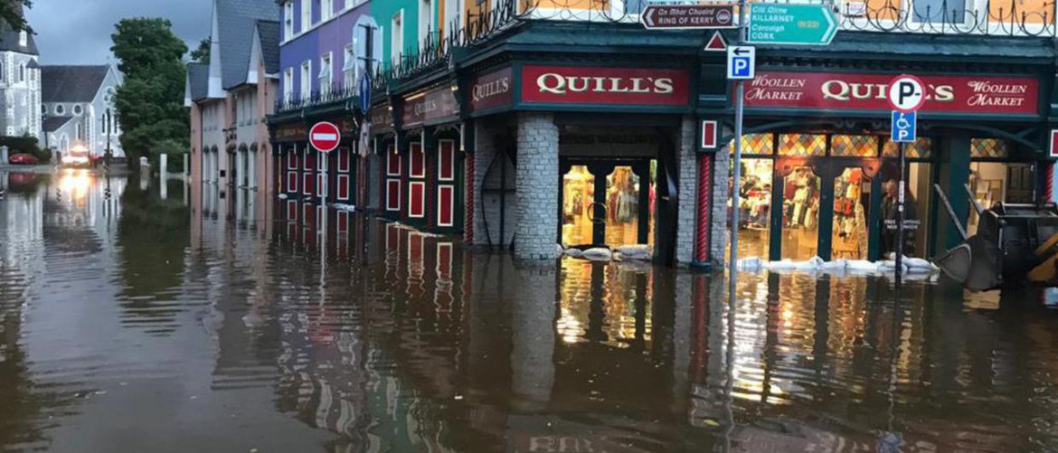
Kenmare has a long history of recurring coastal and fluvial (river) flooding due to its low lying location near the coast and its encrochment onto the flood plain of the Finnihy River and its tributatries which are constrained within the town centre. Recent significant events were recorded in December 2015 and July 2020.
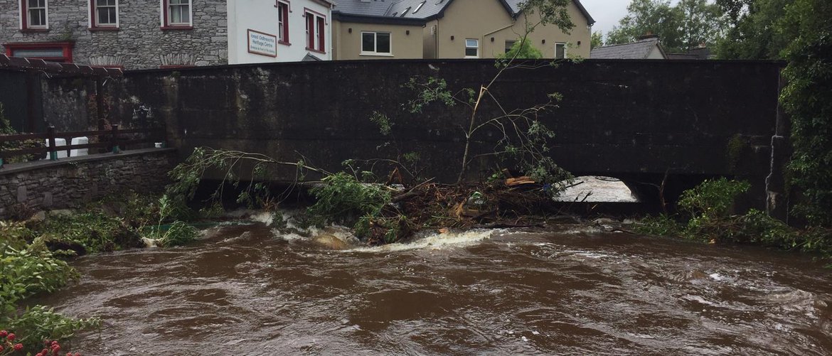
Flooding occurs from the River Finnihy, typically at the bridges (Riverside Villas, N71 and Creamery Road Car Park). Flooding also occurs along the Kealnagower (Lissaniska) stream spilling out of bank in the golf course and at Park Lane Bridge, causing further problems at Scarteen Park. Extreme tidal flooding causes backwater up to Finnihy Bridge, which when combined with high river flows and surface water issues causes flooding in the town square area, Finnihy Banks Estate, Covent Grounds and Gortamullen area. There is also reoccurring flooding on the N71 north of Kenmare suspension bridge, at Kenmare Pier and access road (L7606) and along the roughty / Gortalinny road (L4055).
Kenmare Flood Relief Scheme
To address flooding issues nationally, the Office of Public Works (OPW) commissioned and completed Catchment Flood Risk Assessment and Management (CFRAM) studies covering the entire country. The South-Western CFRAM study was completed with support from Kerry County Council. An output of the study identified flood risk areas and associated impacts of flooding. Kenmare was identified as an Area for Further Assessment (AFA). The CFRAM study also outlined potential measures and policies to be pursued in order to achieve the most cost effective and sustainable management of flood risk.
As part of the Government’s National Development Plan 2018-2027, €1 billion has been committed to the development of flood relief measures across Ireland. As part of this commitment, a steering group was established between the OPW and Kerry County Council to progress a flood relief scheme to alleviate the risk of flooding for Kenmare.
In May 2022, Ayesa (formerly ByrneLooby) were appointed Engineering and Environmental Consultants to develop a scheme that is technically, socially, environmentally, and economically acceptable, to alleviate the risk of flooding to the community of Kenmare.
Ayesa will identify appropriate flood risk relief measures for Kenmare and prepare the required detailed design, drawings and documents necessary to progress the scheme through the appropriate statutory consensus process and subsequent construction of the scheme. Ayesa will prepare a Natura Impact Statement and Environmental Impact Assessment Report, where required under the relevant legislation.
This website has been setup to provide information to the public and to keep you informed of progress on the project.