News
News Article No.19 January 2026
Dublin City, Dun-Laoghaire-Rathdown County Council, the Office of Public Works and Ayesa would like to inform residents of Newsletter No. 19, downloadable in the link below:
News Article No.18 June 2025
Dublin City, Dun-Laoghaire-Rathdown County Council, the Office of Public Works and Ayesa would like to inform residents of Newsletter No. 18, downloadable in the link below:
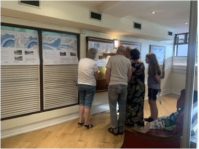
Notice: Public Participation Event June 2025
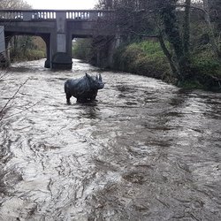
Residents, businesses and other interested parties are invited to attend a Public Participation Event for the River Dodder Flood Alleviation Scheme Phase 3 on the 18th June 2025 at the Dropping Well Pub, Milltown Road, Dublin from 2pm till 8pm.
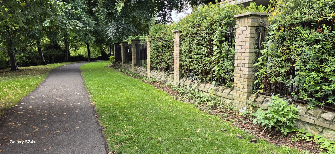
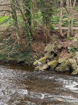
The purpose of the upcoming Public Participation Event is to present the preferred flood mitigation measures between Clonkeagh Road Bridge and Orwell Road Bridge and at on the Little Dargle Stream at Braemor Road-Woodside Drive south-eastern junction.
Representatives of Dublin City Council in partnership with Dún Laoghaire-Rathdown County Council, the Office of Public Works and Ayesa Consulting Engineers will be present to gather your views on the proposed defences, and to engage with the public and stakeholders directly to outline these measures and the programme for delivering the scheme.
All comments received will be considered in the final development of the emerging preferred flood measures.
Information presented on the day will be uploaded on the 18th June 2025 on “Public and Stakeholder Engagement” section of this website.
Notice - Ground Investigations Continuing - May 2025
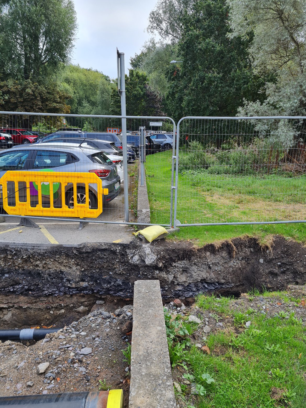
Ground Investigation works are continuing at present. IGSL are working on behalf of Dublin City Council and Dun Laoghaire Rathdown County Council to conduct the works for the River Dodder Flood Allevation Scheme. At present all slit trenches, trial pits and cable percussion boreholes have been completed, except for Orwell Walk/Gardens. Additionally, some indow sampling and some rotary coring works are outstanding and additional archaeological test trenches are being considered. The results of laboratory testing of the ground material has begun.
Road and access restrictions are generally now complete, but any required will be co-ordinated with the relevant stakeholders. This will include some impactful closures and restriction at Orwell.
Notice - Ground Investigation Commencement - 09 December 2024
Ground Investigation works are due to commence Monday 09th of December 2024 for twelve working weeks. IGSL are working on behalf of Dublin City Council and Dun Laoghaire Rathdown County Council to conduct the works for the River Dodder Flood Allevation Scheme. The works include slit trenches, trial pits and exploratory boreholes across the scheme area. The results of laboratory testings of the ground material will inform the design of the scheme. Road and access restriction are anticipated and are being co-ordinated with the relevant stakeholders.

News Article No.17 November 2024
Dublin City, Dun-Laoghaire-Rathdown County Council, the Office of Public Works and Ayesa would like to inform residents of Newsletter No. 17, downloadable in the link below:

News Article No.16 July 2024
Dublin City, Dun-Laoghaire-Rathdown County Council, the Office of Public Works and Ayesa would like to inform residents of Newsletter No. 16, downloadable in the link below:
News Article No.15 February 2024
News Article No. 15:
Dublin City, Dun-Laoghaire-Rathdown County Council, the Office of Public Works and Ayesa would like to inform residents of Newsletter No. 15, downloadable in the link below:
News Article No. 14 September 2023
Update on project activities from July to September 2023 below:
Public Participation Event
A Public Participation Event (PPE) was held in June 2023 where stakeholders and the general public were given an update on the engineering and environmental assessments carried out for the proposed Scheme. Possible flood relief measures were presented for seven flood cells along the River Dodder including one at the Little Dargle. Options were presented for two of the seven areas. The details of the possible measures including options can be found here:
Link to PPE material. https://www.floodinfo.ie/frs/en/dodder-phase-3/project-info/public-engagement/#:~:text=Stage%20I%20Public%20Participation%20Event.
An in-person event was held at the Dropping Well on 22nd June and was well attended. Responses to the event were collected up to the 22nd July and a report on the event was prepared and can be found here. A link to Public Participation Event can be found below:
Public Participation Event Report
Engineering Design
Scheme development has continued, taking account of the results of environmental surveys and comments/submissions from various stakeholders. Emerging flood relief measures are well advanced for some areas with further work to be done in Dartry Park, along Milltown Road and at Clonskeagh Road.
A tender for Ground Investigations has been advertised and responses received. A recommendation on a preferred Contractor to carry out the works has been made. Ground investigation works are expected to be carried out in quarter 4 of 2023 along the full extent of the Scheme from Orwell Road (Waldron’s) Bridge to Clonskeagh Bridge and by the Little Dargle at the junction of Braemor Road and Woodside Drive. The results of the investigations will inform the design of the various flood relief structures required for the Scheme.
Treatment of Invasive Alien Species along the potential work areas of the Dodder Flood Alleviation Scheme was carried out over the summer and early autumn. The invasive species include Japanese Knotweed, Himalayan Balsam and Winter Heliotrope. This treatment work will have a long-term positive effect on the immediate environment where treatment has taken place. As the die-off of the invasive species takes place, it gives the opportunity for native species to establish in the area.
Environmental Surveys and Assessments:
With the kick-off of the project, a number of environmental surveys were undertaken. These originally occurred in 2020, during the covid-19 pandemic lockdown. A number of these, such as the air quality monitoring and noise surveying are currently being updated to ensure accuracy as these were potentially influenced by the lockdown.
The project ecologist undertook a site walkover to re-assess the habitats and species present. Due to potential changes that have occurred since the original surveys were carried out in 2020/2021, a number of surveys will be repeated in 2023/2024. These include:
- Mammal surveys
- Breeding bird surveys
- Wintering bird surveys
- Bat surveys
An Arboreal specialist has carried out a tree survey and prepared an arboreal impact assessment for the Scheme. This tree survey found that there are some trees in bad condition and will require felling as they may pose a danger to the public. Other trees that may be impacted by the works were identified. The impact assessment examined the impact that the scheme could have on the trees in the area The engineering team will work on realignment of flood defences where possible to minimise these impacts. However, some trees would have to be removed to allow space for the flood defence walls and embankments and also working space for construction of the proposed Scheme. As part of the proposed Scheme, new trees would be planted, both on and offsite.
News Article No. 13: Public Participation Event June 2023
Residents, Businesses and other interested parties are invited to attend a Public Participation Event for the River Dodder Flood Alleviation Scheme Phase 3 on the 22nd June 2023 at the Dropping Well Pub, Milltown Road, Dublin from 2:30pm till 8:00pm.
The purpose of the upcoming Public Participation Event is to present the potential flood mitigation measures between Clonkeagh Road Bridge and Orwell Road Bridge and at on the Little Dargle Stream at Braemor Road-Woodside Drive south-eastern junction).
Representatives of Dublin City Council in partnership with Dún Laoghaire-Rathdown County Council, the Office of Public Works and ByrneLooby Consulting Engineers will be present to gather your views on the proposed defences, and to engage with the public and stakeholders directly to outline these measures and the programme for delivering the scheme.
All comments received will be considered in the development of the emerging preferred flood measures.
Information presented on the day will be uploaded on the 22nd June 2022 on “Public and Stakeholder Engagement” section of the website.
News Article No. 12 March 2023
A brief update on the scheme activities from December 2022 to March 2023 below:
Development of Flood Risk Management Options
Economic damages assessment for the Scheme is complete. The assessment provides estimates of tangible and intangible impacts caused by flooding for a range of percentage annual exceedance periods (% AEP). The steering group has reviewed the draft Multi-Criteria Assessment (MCA) developed for identification of an emerging preferred option. Final MCA will be completed once the emerging preferred option has been defined.
Currently, a list of flood risk management measures is being assessed to evaluate the most effective options for the scheme area. The most effect options for the scheme area are currently under review which are mostly in park areas of the scheme.
Following development of the emerging preferred option, the modelling of the option will be conducted and results will be presented at next Public Consultation Day in summer 2023.
Environmental Assessment:
The Environmental Impact Assessment (EIA) Scoping Report has been completed and approved by the Steering Group. This report has been circulated to Statutory Stakeholders for comment, as part of the consultation process required of the Environmental Impact Assessment (EIA). Responses will be taken into consideration within the EIA Report.
Three draft chapters of the EIA Report have been issued to the Steering Group for comment, and all remaining are to be developed once the preferred scheme is chosen and the design is further progressed.
Photographs for the preparation of photomontages have been taken throughout the scheme area. The photomontages will be prepared once the scheme design is completed.
A series of comprehensive environmental baseline surveys have been completed, the results of which are being used to inform the assessment of options and environmental impacts. Outstanding is the completion of an assessment of the potential impact on trees, to further inform the scheme design in areas where important trees are at risk of removal or damage (i.e., root damage or trimming).
Work will recommence in April on the treatment of Invasive Alien Species along the potential work areas of the Dodder Flood Alleviation Scheme. These invasive species include Japanese Knotweed, Himalayan Balsam and Winter Heliotrope.
An Appropriate Assessment (AA) Screening Report is being prepared for the Site Investigation works proposed within the scheme area, to determine the requirement for a full Natura Impact Statement (NIS).

News Article No.11 November 2022
News Article No. 11:
Dublin City, Dun-Laoghaire-Rathdown County Council, the Office of Public Works and ByrneLooby would like to inform residents of Newsletter No. 2, downloadable in the link below:
News Article No. 10: August 2022
A brief update on the scheme activities from May 2022 to August 2022 is provided below:
Hydrological Assessment:
The latest verision of the Hydrology Report has been added to the website. See link below:
Hydraulic Modelling:
The computer model representing the River Dodder and its tributaries is now complete and is being used to inform the potential options for the River Dodder Flood Alleviation Scheme Phase 3. A draft verision of the Hydraulics Report has been reviewed by the Steering Group and is currently being updated. The technical report provides details on how the computer model was constructed and calibrated and describes the modelled flood extents and levels which are now being used in Scheme Development.
Development of Flood Risk Management Options:
A short list of flood risk management measures has been assessed in the model to evaluate the most effective options for the scheme area. These options will be assessed in detail throughout a Multi-Criteria Assessment (MCA) to assist in the identification of an emerging preferred option.
An economic damage assessment is ongoing for River Dodder Flood Alleviation Scheme Phase 3. This will provide estimates of the tangible and intangible impacts caused by flooding, from which the potential benefits of the flood scheme can be calculated across a 100-year design life. This assessment will help inform what potential options are economically viable, when compared against the whole life cost of the option.
Environmental Assessment:
The Environmental Screening Report has been completed and approved. This available at the link below:
The Environmental Scoping Report has been completed and approved by the Steering Group. This report has also been circulated to Statuory Stakeholders for comment as part of the Environmental Impact Assessment (EIA) process.
All environmental baseline surveys have been completed, the results of which are being used to inform the assessment of options and impacts. ByrneLooby's Environmental team is currently progressing with the various chapters of the EIA Report for the scheme. Upon identification of the preferred option, impacts and mitigation measures will be considered and the EIA Report will be completed for review.
Work is continuing on the treatment of Invasive Alien Species along the potential work areas of the Dodder Flood Alleviation Scheme Phase 3. These invasive species include Japanese Knotweed, Himalayan balsam and Winter Heliotrope.
News Article No. 9: May 2022
A brief update on the scheme activities from January 2022 to April 2022 is provided below:
Hydrological Assessment:
The hydrological analysis has been completed and agreed in principle for the scheme. The Hydrology Report has been finalised following completion of baseline hydraulic model. Flood flows for the watercourses in the area, including the River Dodder, Little Dargle and River Slang have been defined for the design flood event (1% AEP or 1 in 100-year flood event).
Hydraulic Modelling:
Substantial work has been completed on the hydraulic model. The baseline model has now been calibrated and was run for the existing situation. The modelling results identified the properties in the Scheme Area at risk of flooding for various flood events. The model was then revised to include proposed flood defences and run for a range of flood periods to assess the effectiveness of potential flood mitigation measures. These results will feed into the options appraisal for the scheme to the determine the preferred scheme.
Environmental Assessment:
All specialist surveys and studies for aquatic & terrestrial ecology, landscape & visual, archaeology, cultural heritage, noise, vibration and air quality have been completed.
The environmental team have now commenced with the Scoping Report for the Environmental Impact Assessment (EIA). The purpose of scoping is to identify the information to be contained in the Environmental Impact Assessment Report (EIAR) and the methodology to be used in gathering and assessing that information. It should provide focus for the EIAR and thus enable the environmental impact assessment to be appropriately tailored to the likely significant impacts on the environment.
Once the Scoping Report is agreed and the preferred option identified, the preparation of the EIA Report will commence.

News Article No. 8: December 2021
A brief update on the scheme activities from October 2021 to December 2021 is provided below:
Hydrological Assessment:
The draft hydrology report has been updated following completion of the baseline hydraulic model. The baseline model results represented the flows in the rivers during the flood events as well as the extents of the flooding. This provides confidence that the analysis completed of flows in the river mimics historic flood events that occurred. Previous flood event information received from the public and Dublin City and Dun Laoghaire-Rathdown County Councils is being used to verify the baseline model flood extents.
Hydraulic Modelling:
The baseline hydraulic model of the scheme is completed. The calibration and validation of the hydraulic model is underway using data from historical flood events to ensure that it provides an accurate representation of the flooding mechanisms. The baseline model calibration maps will be submitted to the Steering Group for review. Once this is approved the model will be used to produce flood maps and assess and compare various options to alleviate the flood risk.
Environmental Assessment:
The Environmental Impact Assessment (EIA) is currently awaiting finalisation of the scheme options before proceeding further. All specialist surveys and studies for aquatic and terrestrial ecology, landscape and visual, archaeology and cultural heritage, noise and vibration and air quality have been completed, with only the aquatic ecology and underwater archaeology reporting to be finalised.
Upon completion of the hydraulic modelling and options assessment, the environmental team will review the baseline ecological survey reports prior to commencing with the EIA Scoping Report. This report aims to provide detail of the potential environmental, social, cultural and heritage impacts of the scheme, and outline a methodology for how these impacts will be assessed in further detail within the Environmental Impact Assessment Report (EIAR).
News Article No.7: September 2021
Progress has been steady over the past twenty-three months during the on-going COVID-19 Pandemic. At this stage we would like to provide a brief update on the scheme activities from May 2021 to September 2021:
Hydrological Assessment:
The draft hydrology report has been completed for the Scheme area. The report details the analysis completed to define the flows in the rivers during the flooding events. This is a key part in defining how the watercourses in the area respond during flood events. The hydrology focuses on the large Dodder Catchment and the Little Dargle catchments. Understanding how these catchments act a key step is in defining flood risk and developing flood protection measures for the Scheme.
The final hydrology report is currently underway with completion aimed for November 2021.
Hydraulic Modelling:
The hydraulic modelling for the scheme is done using a computer software package to model the watercourses, drainage infrastructure and overland surface. The calculated hydrology is an input to model which is used to represent flood mechanism and evaluate the technical viability of potential flood mitigation measure. Past flood events are used in calibrating the model to ensure it is representative of the flood history in the Scheme area.
Baseline model development is currently underway. The modelling results deduced will identify the properties in the Scheme area at risk of flooding.
News Article No. 6: May 2021
Progress has been steady over the past eighteen months during the on-going COVID-19 Pandemic. At this stage we would like to provide a brief update on the scheme activities from December 2020 to May 2021:
Topographical Survey:
The Topographical Survey is complete which includes a level and position survey of the river channel and flood plain as well as all of the structures along the River Dodder including bridges, weirs, walls, etc. A building threshold survey for properties within the flood extent area was also undertaken. Dublin City Council and project team would like to thank the public in assisting the nominated service provider in the completion of the survey.
Culvert Condition Survey:
The Culvert Condition Survey is complete which includes route tracing, geometric measurement and CCTV survey as well as a condition assessment of culverts. Dublin City Council and the project team would like to thank the public in assisting the nominated service provider in carrying out this survey.
Riverbank and Structural Condition Assessment:
The riverbank and structural condition site surveys are completed. Formal and Informal flood defences assessed will be considered as part of the proposed flood alleviation measures for the scheme.
Hydrological Assessment:
A rating review analysis of Waldron’s Bridge gauge station is currently underway. Results from the analysis will inform necessary inputs to the baseline hydraulic model development.
Environmental Assessment:
Overall, the environmental deliverable for the scheme is progressing in line with the required programme. This quarter, two key deliverables have been prepared as follows:
- Environmental Constraints Report for the whole scheme; and
- Environmental Impact Assessment (EIA) Screening Report for the whole scheme.
In addition, further specialist surveys have been continuing to ensure that an up-to-date baseline is established, which forms the basis of the EIA. Specialist surveys completed to date and/or ongoing include:
- Terrestrial ecology surveys (habitats, birds, mammals (e.g. badger, otter, bat), herpetofauna (e.g. reptiles and amphibians), flora, trees, invasive species).
- Aquatic ecology surveys (fish survey, Q values and macroinvertebrate, macrophytes survey, aquatic invertebrate).
- The 2020 invasive alien species survey was updated in March-April 2021.
The next key deliverable for the environmental team is the Environmental Impact Assessment Scoping report, which considers the potential issues relating to the proposed Flood Relief Scheme and discusses which issues are likely to be significant. It will outline how the EIA will deal with each of the issues raised, providing the scope for further desk-based study and site surveys as required. Screening for Appropriate Assessment will also be completed for the scheme as a whole.
Following this the EIA will be carried out with the EIA Report currently scheduled for delivery in Spring 2022.
News Article No. 5: December 2020
Progress has been steady over the past twelve months during the on-going COVID-19 Pandemic. At this early stage we would like to provide a brief update on the scheme activities from November to December 2020 as follows:
Data Collection:
Data collection is complete at this juncture. If any members of the public have any information which could be of use, please contact us.
Topographical Survey:
Dublin City Council have appointed Murphy Surveys to conduct topographical, channel, structural, flood defence and building threshold surveys. During this period, we urge the public to assist the nominated service providers by providing access where possible during their surveys.
Culvert Condition Survey:
Dublin City Council have appointed Ameilo Utilities Ltd to conduct culvert condition survey including CCTV. During this period, we urge the public to assist the nominated service providers where possible during their surveys by provide access.
Hydrology Assessment:
The hydrological analysis, which includes an assessment of the frequency and magnitude of river flows over a range of scenarios is complete. This, along with the survey data, will provide the necessary inputs to the computer model as part of the hydraulic modelling.
Hydraulic Assessment:
Preparation of a baseline model will commence following receipt of the topographical survey information. It is expected this will occur in January 2021.
Environmental Assessment:
Dublin City Council has appointed a number of service providers for ecological surveys along the River Dodder and Little Dargle stream. These surveys include habitats, bat surveys, bird surveys, fish surveys, water quality surveys, invasive species surveys, noise & vibration surveys, land and visual surveys and architectural & cultural heritage surveys in addition other species or features of ecological or environmental interest. All these surveys are ongoing, and it is anticipated that surveys will be complete by February 2021.
A Constraints Report which summarises the main environmental and other project contracts is complete. This will inform the EIAR assessments once the proposed scheme has been defined. EIA screening report has commenced, this will establish whether an EIA is required for the scheme.
News Article No.4: October 2020
Newsletter No. 4
Dublin City Council, Dun Laoghaire-Rathdown County Council, the Office of Public Works and ByrneLooby would like to inform residents of Newsletter No.1, downloadable in the link below.
News Article No.3: April 2020
COVID-19 Update
Due to the ongoing COVID-19 pandemic, early stage works such as site walkovers and site visits to establish and scope surveys and environmental baselines may be affected.
Dublin City Council, Dun Laoghaire-Rathdown County Council, the Office of Public Works and ByrneLooby would like to advise that these activities will re-commence as soon as possible.

News Article No.2: March 2020
Public Consultation Day No. 1 – Response
Dublin City Council, Dun Laoghaire-Rathdown County Council, the Office of Public Works and ByrneLooby would like to thank all attendees who took part in the Public Consultation Day held on the 14th January 2020 at Dropping Wells Pub, Dublin.
All questionnaires from the Public Consultation Day have been received via email, post and hand delivery.
At this early stage we would like to inform members of the public that a formal response with regards to the questions received shall be provided after all submissions have been reviewed and the early stages of the project have progressed to point where informed responses can issue.
News Article No.1: January 2020
Project Commencement
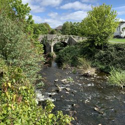
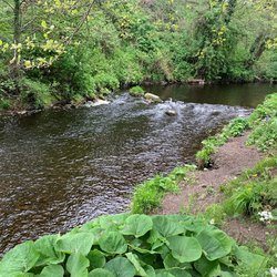
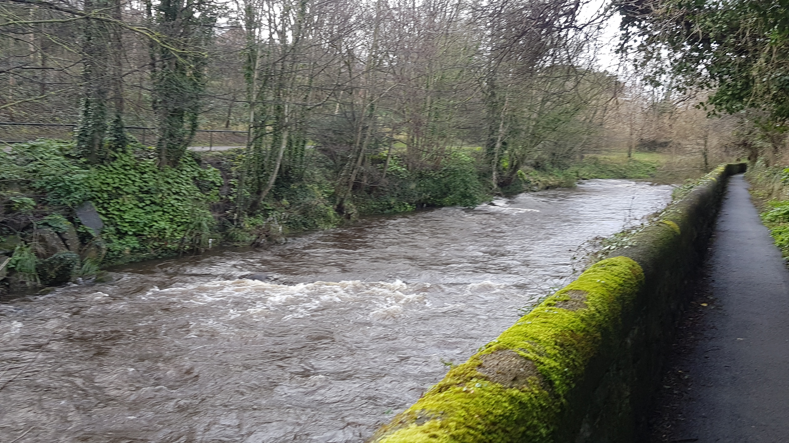
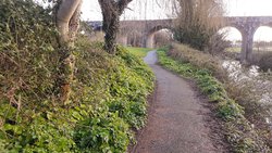
Dublin City Council has commissioned ByrneLooby (BL) to develop and implement a flood alleviation scheme (FAS) for the River Dodder from Clonskeagh Road Bridge to Orwell Road Bridge including flood defence works on the Little Dargle stream at Braemor Road-Woodside Drive south-eastern junction. This project is known as the River Dodder Flood Alleviation Scheme Phase 3.
Public Consultation Day No. 1
We invited residents, businesses and interested parties to attend the Public Consultation Evening for River Dodder Flood Alleviation Scheme Phase 3.
Representatives from the scheme’s engineering design team, environmental consultants, the Office of Public Works, Dublin City Council and Dun Laoghaire County Council met with and explained the scheme’s objectives and aims to members of the public at the Dropping Wells Pub, Milltown, Dublin on the 14th January 2020.
We would still like to hear about your experience on past floods. Pictures/ Videos of the day/ night of any previous floods you have experienced will be informative to us.
At this early stage we welcome appreciate any ideas and thoughts on possibilities and limitations for flood Relief Scheme so we can take your views into account as we start to develop the scheme options.