Timeframe
Project Timeframe
The project will comprise five stages, as set out below:
Stage 1
Development of a number of flood defence options and the identification of a preferred Scheme.
Completed Spring 2016
Stage 2
Public Exhibition of Scheme.
Completed Winter 2016
Stage 3
Detailed Design, Confirmation and Tender.
Completed Summer 2023
Stage 4 & 5
Construction and Handover of the Works.
Commenced Summer 2023
The scheme will be funded from within the allocated €1 billion for flood risk management over the period 2018 – 2027. Provision for the cost of the Scheme is included in the Office of Public Works' multi annual capital allocation.
The Key Public Consultation Dates were as follows:
Public Consultation Day No. 1:
Constraints Stage
26th February 2014
Public Consultation Day No. 2:
Emerging Preferred Option
20th February 2015
Public Consultation Day No. 3:
Statutory Exhibition of Scheme
November - December 2016
The main elements of each stage are described below:
Stage 1 – Scheme Development
- Assess and develop a viable, cost-effective and sustainable Scheme, to allow the design flood event along the Glashaboy River and its tributaries without causing flooding of properties, in so doing protecting against flooding from pluvial, fluvial, tidal and surge.
- Carrying out a Constraints Study to identify the key environmental issues in the study area, which may be impacted upon by possible flood alleviation measures, and/or which may impose constraints on the design and viability of these measures.
- Preparation of the Appropriate Assessment Screening Statement
- Public consultation, including Public Information Days. The purpose of the first Public Information Day will be to gather information from the public about their experiences of flooding in the Study Area along with their thoughts on possible solutions to the flooding problem and their preferences in this regard.
Stage 2 – Public Exhibition
- Public Exhibition of the Scheme in accordance with the requirements of the Arterial Drainage Acts, where the public's view of the proposals will be ascertained.
- Consideration of observations received from the public and the making of possible amendments to the Scheme.
- Preparation of Environmental Impact Statement (EIS) for the Scheme.
Stage 3 – Detailed Design, Confirmation and Tender
- Undertaking the detailed design of the final preferred scheme.
- Confirmation of the Scheme by the Minister for Public Expenditure & Reform.
- Preparation of Contract Documents and undertaking the procurement of a Works Contractor to construct the Scheme.
Stages 4 & 5 – Construction and Handover of the Works
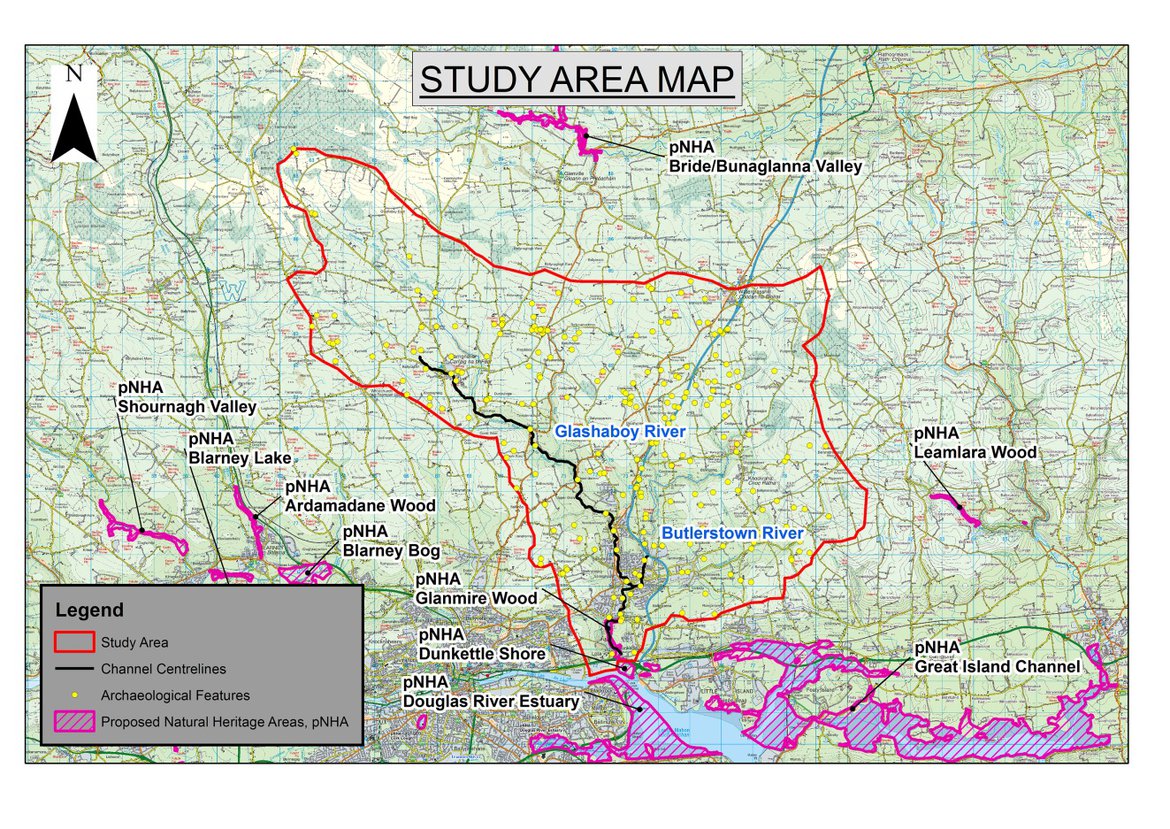
Study Area
The study area consists of:
The Glashaboy River and Estuary, and its tributaries including the Butlerstown River.
Click here to see how this community was assessed.
(You will be redirected to Floodinfo.ie)