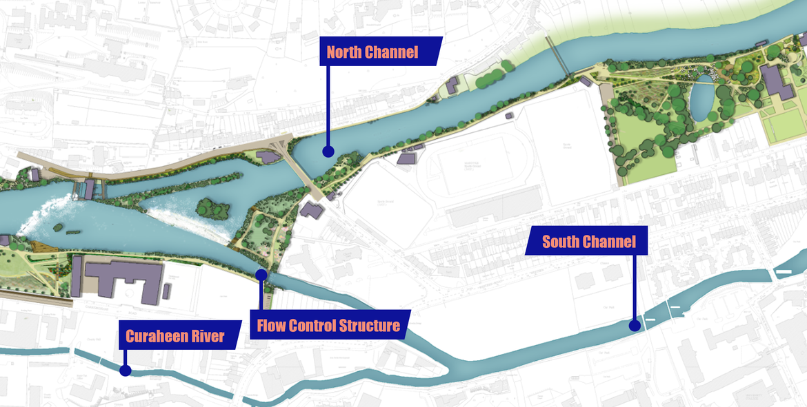
Managing Flow between the North & South Channel Page

Flow in the south channel is as a result of flow from both the Lee catchment and the Curaheen and Glasheen catchments. The reach of the Curaheen channel immediately upstream of the south channel is very flat. The floodplain in the area is shared by both the Lee and the Curaheen. This means that large Lee flood events can spill into the Curaheen channel via this floodplain. The capacity of the South Channel is much smaller than the North Channel and is restricted by a number of low-lying bridges.

At present, during major flood events, a disproportionate proportion of the Lee flow is conveyed by the south channel, Curaheen and its floodplain. Because of its shallow gradient and low capacity, if the existing flow split were to be retained, several kilometres of extremely high defences (in excess of 2 metres high) would be required along significant reaches of both the lower Curaheen and the south channel. Such high defences are neither desirable nor sustainable.

Therefore, the Scheme proposes to better balance the proportion of flow taken by each channel depending on the respective river flows in the Lee, Curaheen and Glasheen, as well as considering the influence of the tide.

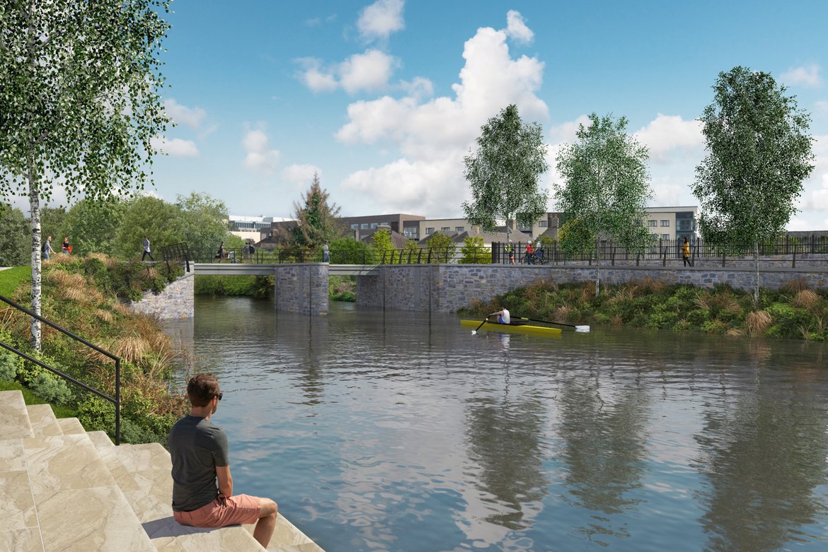
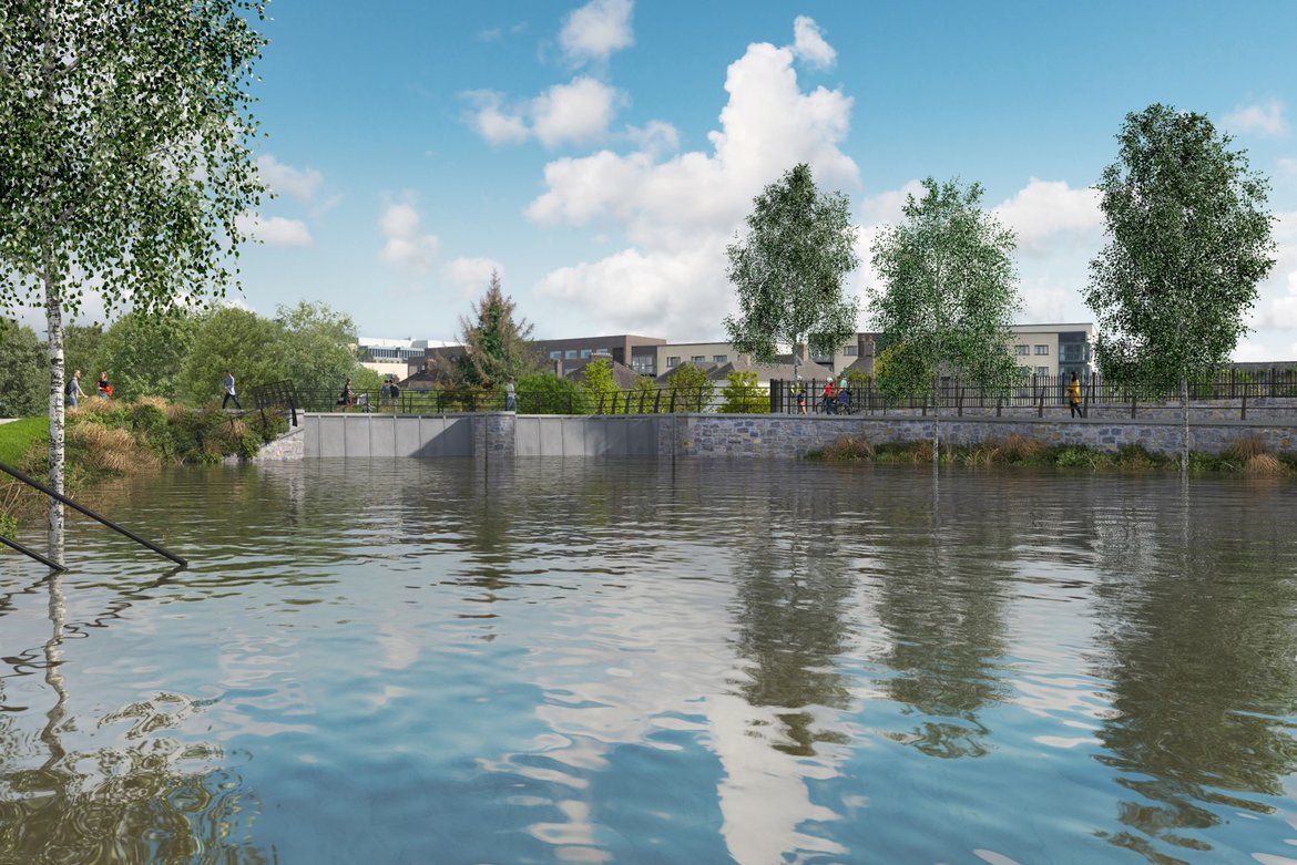
This is achieved through the incorporation of a flow control structure at the head of the south channel. Most of the time, this structure will remain open, and the regime will remain as it is at present. However, during extreme river floods and/or extreme tides, the flow control structure will be closed, allowing only a small environmental flow into the south channel from the Lee with the vast majority of the Lee flow being conveyed along the North Channel, with the south channel conveying the Curaheen flow and the environmental flow from the Lee.

Better Managing of Flow between the North and South Channel

In such cases, whilst the vast majority of the Lee design flow will now be conveyed by the North Channel, the 1% design flow in the North Channel will still be less than it is at present because of the positive role played by the change in dam operation.

Essentially, the combination of the revised dam operation and this flow control structure working in a systematic way, help to reduce the design flow and levels in both the North and South Channel. This means that very little of the south channel and Curaheen channel requires flood defences save for the eastern end where low level tidal defences are required. Defences are required on the North channel, but these are generally low-level defences and can be integrated seamlessly into the urban landscape.

The flow control structure has been designed such that when open, it does not dimmish the current navigational use of this reach of channel for river users such as kayakers and canoeists etc.

Analysis undertaken confirms that the structure is likely to require closure for only a few days a year on average, predominantly in the winter months. Even when closed, the flow control structure will ensure that a minimum environmental flow will continue to be allowed down the south channel to protect important environmental habitats and the structure has been designed to allow routine maintenance to be undertaken whilst still maintaining through access for river users.

Flow Control Structure in open position

Flow Control Structure in closed position


Postal address: OPW, 1 George's Quay, Dublin, D02 Y098

Email: lowerleefrs@arup.com

Follow us on Twitter:   @opwireland  @llfrscork | Instagram:   llfrscork | Facebook:  LLFRSCORK

Copyright 2020, All rights reserved

Privacy Statement


OPW's National Flood Information Portal - www.Floodinfo.ie