Flood Forecasting System

A key component of the LLFRS is the optimisation of the operation of both hydroelectric dams to regulate flow downstream and thus minimise flood impacts during periods of extreme rainfall and/or high tides.

To maximise the benefit, it is imperative that there is good foresight of high tides and large rainfall events. Accordingly, as part of LLFRS, a state of the art integrated fluvial and tidal flood forecasting system has been developed to inform the operation of the dams during times of high flood risk. The systems uses both high resolution rainfall forecasts as well as real time recorded rainfall, forecasted astronomical tides as well as predicted surge (based on forecasted wind speed and direction and forecasted astronomic pressure). The system also includes error correction based on record water levels at key points along the main watercourses to take account of catchment wetness.

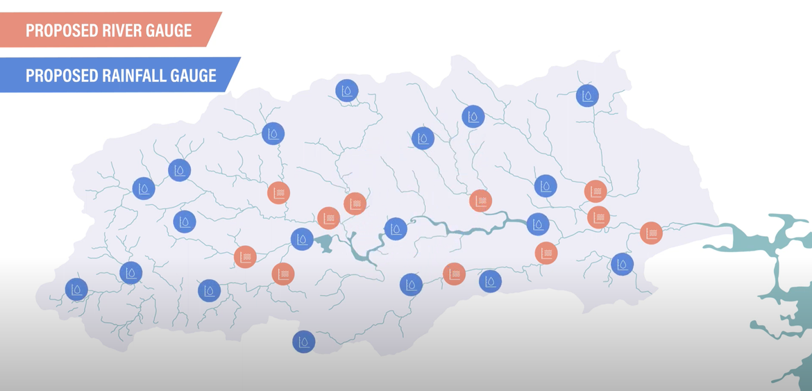
Key to the success of the system will be reliable data. In terms of forecasted data, the system uses the highest resolution data available from Met Eireann (Harmonie) as well as data from the European Centre for Mid-Range Weather Forecast (ECMWF). In terms of real time data, the system will use a comprehensive network of rainfall and river gauges.

As part of its national hydrometric programme, OPW has implemented a comprehensive upgrade of its gauge network in the Lee Catchment (both rainfall and river gauges) which are now providing a higher resolution of data on rainfall and river flow in the catchment. The network of gauges includes significant redundancy and backup systems.

Introducing State of the Art Flood Forecasting

Over the last number of years, these improved datasets and forecasts has allowed OPW and its consultants to undertake a detailed calibration of the flood forecasting system and its proposed role in further optimising the operation of the ESB dams during flood events. This has facilitated the continual enhancement of the performance of the system, to further optimise the management of the dams for flood risk management.

The development of the Flood Forecasting System has now been substantially completed in readiness for when the other flood defence components are constructed. Before then, it is continually operating in the background providing those involved in the operation of the Scheme with invaluable insight and understanding of how the system will be operated when the Scheme is in place.

With the improvements to the flood forecasting system, and increased data and forecast accuracy, over the last few years, it has been possible to further enhance the proposed operational rules as follows:

  • Whilst the original operational system was developed to be operationally robust and was focussed primarily on managing the design 1 in 100 year event, the additional data and analysis in the subsequent period, has allowed further refinements to be made, that now allow small and medium events to be more effectively managed, by reducing the scale and duration of pre-emptive releases from the dams, and thus reducing the impact on agricultural lands and river users.
  • The system has also now been further refined to explicitly manage releases from the reservoirs in consideration of the tide, by offsetting the largest releases from the highest tides, thus minimising flood levels. This will reduce the operational demands on the local surface water pumping stations (lower energy costs) and reduce the required frequency of erection of demountable barriers.


Postal address: OPW, 1 George's Quay, Dublin, D02 Y098

Email: lowerleefrs@arup.com

Follow us on Twitter:   @opwireland  @llfrscork | Instagram:   llfrscork | Facebook:  LLFRSCORK

Copyright 2020, All rights reserved

Privacy Statement


OPW's National Flood Information Portal - www.Floodinfo.ie