Project Background and Timeframe
How did we get here?
Midleton and surrounding areas have experienced a number of extreme flood events in recent years. This project follows on from the Lee Catchment Flood Risk Assessment and Management Study (CFRAMS) and the major flood event of December 2015.
Further to this study and review of past flood events, Cork County Council has recognised that there are four sources of flood risk in the Owenacurra and Dungourney River catchments comprising of fluvial (river), tidal, pluvial (rainfall) and groundwater flooding. Cork County Council, acting as an agent for the Office of Public Works (OPW), intends to develop a robust flood relief scheme to address these flood sources.
The Draft Catchment Flood Risk Management Plan was published in February 2010 and recommended the following for the Midleton sub-catchment:
-
Review feasibility of Fluvial Flood Forecasting System
-
Targeted Public Awareness and Education Campaign
-
Permanent Flood Walls and/or Embankments to manage both tidal and fluvial risk, along the Owenacurra River Estuary and along the Dungourney and Owenacura Rivers through Midleton
The purpose of this project is to assess and develop a viable, cost effective and sustainable Flood Relief Scheme to alleviate flooding along the Owenacurra and Dungourney Rivers.
Due to the diversity, complexity and aesthetic sensitivity of the engineering measures required, design consultants with proven specialist expertise have been engaged to carry out the detailed design of the scheme. Arup has been appointed by Cork County Council to undertake the design and implementation of the Midleton FRS. Arup will be designing the flood defence and river engineering works, and preparing the Environmental Impact Assessment.
In order to assist the engineering consultants with their design, a number of specialist consultants will be engaged to address certain areas including; Ecology, Fisheries and Cultural Heritage. Particular attention will be paid to the appearance of the works and the visual amenity of the riverscape, including at the Baby Walk Park.
Click to see how this community was assessed.
(You will be redirected to Floodinfo.ie)
Project Timeframe
The project will comprise five stages, as set out below (please note the timelines are the best estimate at the time of writing):
Stage 1
Development of a number of flood relief options and the identification of a preferred Scheme
Complete by end of 2023
Stage 2
Planning Process
Commence in 2024
Stage 3
Detailed Design and Tender
Commence in 2026 (subject to planning consent process)
Stages 4 & 5
Construction and Handover of the Works
Commence in 2028
Stage 1 – Scheme Development
- Assess and develop a viable, cost-effective and sustainable Scheme, to allow the design flood event along the Owenacurra and Dungourney Rivers and their tributaries without causing flooding of properties, in so doing protecting against flooding from pluvial, fluvial, groundwater, tidal and surge.
- Carrying out a Constraints Study to identify the key environmental issues in the study area, which may be impacted upon by possible flood alleviation measures, and/or which may impose constraints on the design and viability of these measures.
- Preparation of the Appropriate Assessment Screening Statement.
- Public consultation, including Public Information Days. The purpose of the first Public Information Day is to gather information from the public about their experiences of flooding in the Study Area along with their thoughts on possible solutions to the flooding problem and their preferences in this regard.
Stage 2 – Planning Process
- Complete the necessary planning and any other statutory processes, to progress the preferred Scheme through Part 10 Planning under the Planning and Development Act 2000 or under Strategic Infrastructure, which may include;
- Submission to An Bord Pleanála,
- Public Display,
- Oral Hearing,
- CPO of lands required for preferred scheme,
- Section 50 licenses, etc.
- Amend the final draft Flood Relief Scheme if and as necessary following completion of the planning and statutory procedures.
Stage 3 – Detailed Design and Tender
- Undertaking the detailed design of the final preferred scheme.
- Preparation of Contract Documents and undertaking the procurement of a works contractor to construct the Scheme.
Stages 4 and 5 – Construction and Handover of the Works
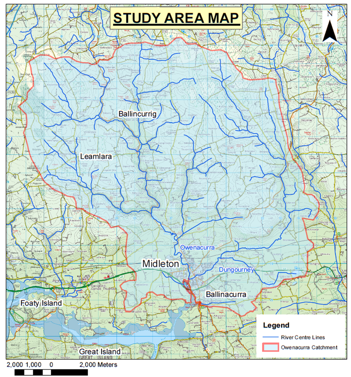
Study Area
The study area consists of the Owenacurra and Dungourney Rivers and their tributaries.