Geophysical Survey
July 2017
Apex Geoservices Ltd. recently carried out a geophysical survey in the Midleton Area. The geophysical survey consisted of 7 survey lines covering a combined length of nearly 4.5 km across a mixture of urban, residential and agricultural land. The survey will aid the geotechnical and hydrogeological investigation of the Flood Relief Scheme.
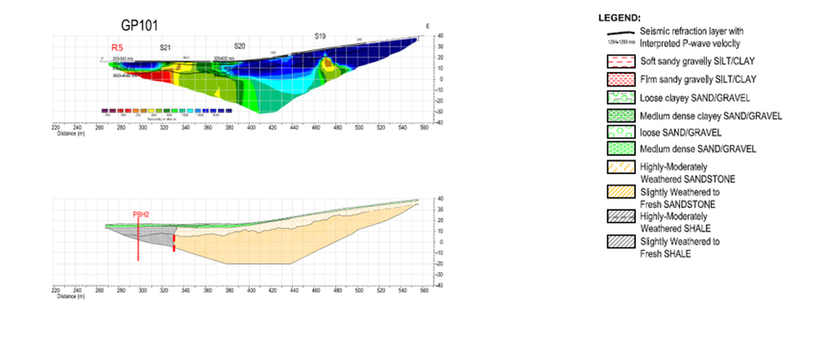
The survey provides information on the width, depth and extend of the paleochannel between rock valleys, the type and thickness of the overburden and depth to bedrock. A sample of the geophysical survey results with geological interpretation is shown below.