Background Information
Project Background
Rosslare Strand in County Wexford is a popular tourist destination in the southeast; it comprises of a low-lying village adjacent to an extensive coastal dune system and is fronted by a sandy beach. There are many notable tourist attractions in Rosslare including the blue flag beach, golf courses and hotels.
The coastline at Rosslare Strand is of soft sand and has been subject to erosion over many decades. Since the 1950's a series of coastal protection measures have been introduced at various sections along the coastline to reduce the rate of erosion. These measures included rock revetments, rock and timber groynes and an extensive beach nourishment programme undertaken in the 1990s. Some of the existing protection measures, like the timber groynes, have now reached the end of their design life. In addition, there are identified areas of the coast that need to be protected in order to safeguard properties, businesses and the community. At the northern section of Rosslare Point, a number of properties are also at risk of coastal flooding.
As part of the Government’s National Development Plan 2018-2027, almost €1 billion has been committed to the investment into flood relief measures across the country. Following on from this commitment, a steering group was established between the Office of Public Works (OPW) and Wexford County Council to progress an erosion and flood relief scheme to protect the Strand at Rosslare and alleviate the risk of flooding for the local community of the peninsula.
Wexford County Council completed the Rosslare Coastal Erosion and Flood Risk Management Study in 2019. The study outlined proposed erosion and flood mitigation measures to address the identified risks and how to best manage and mitigate the overall risks to the community in the village.
In December 2021, Wexford County Council appointed Nicholas O'Dwyer Ltd Consulting Engineers to develop, design, and construct a Coastal Erosion and Flood Relief Scheme (CEFRS), that is technically, socially, environmentally, and economically acceptable, for the community of Rosslare. The appointment will cover all five stages which comprises of preliminary design to statutory consents, to detailed design, tendering, construction and handover.
Click here to view CERMP study and here to view the CFRM study on Rosslare.
Project Area
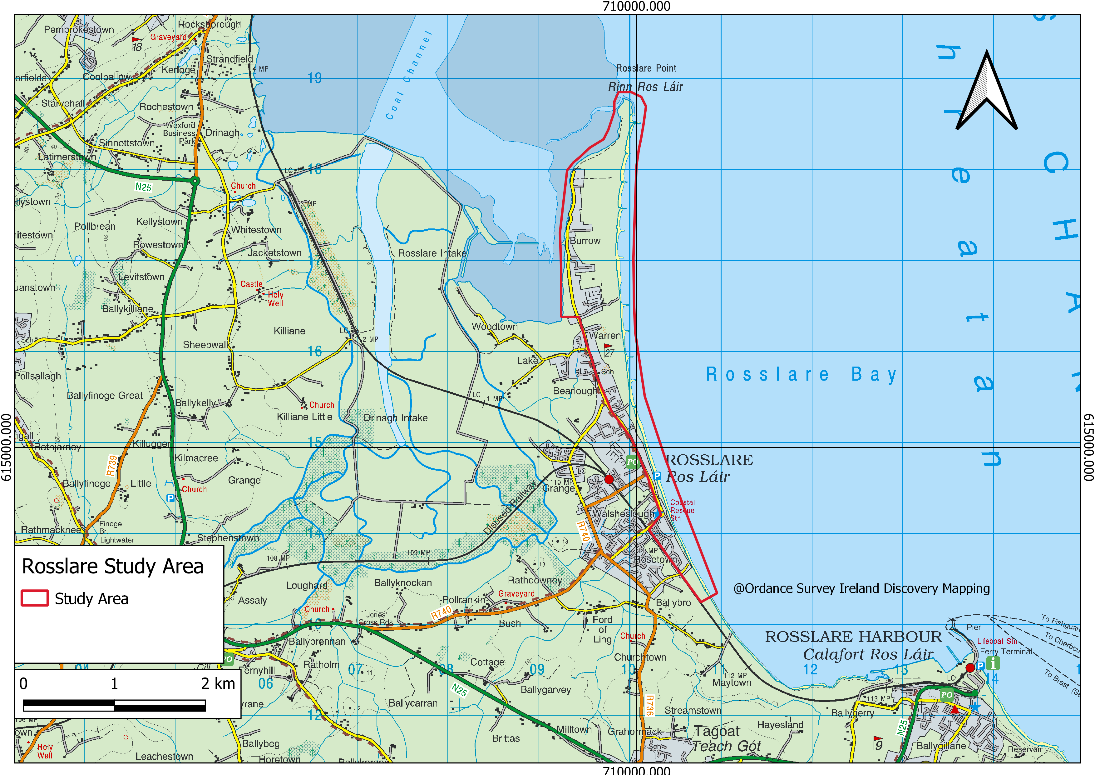
The focus of the Scheme is Rosslare Strand which extends to Rosslare point to the north, Burrow Road to the west and Wexford Bay to the East.
The red outline in the map below covers the study area of this Scheme.