Project Documents
Project Reports
Coming soon
Public Exhibition Map
Coming soon
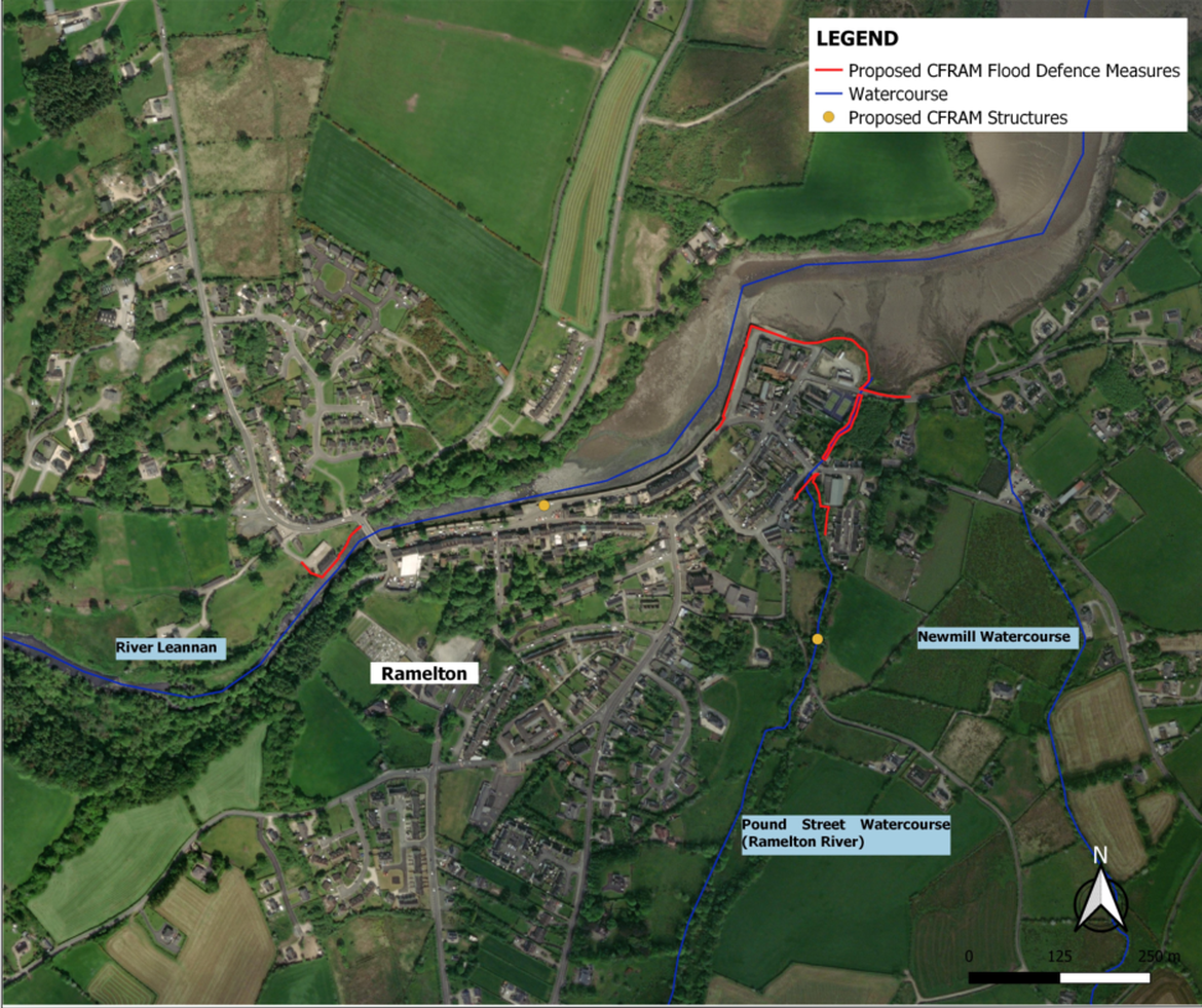
Study Area
The Scheme Area includes:
- Areas within which physical works are proposed to be constructed, accessed and maintained as part of any feasible scheme;
- Areas that are intended to benefit from, and be protected by, any such scheme; and,
- Lengths of river channel / watercourse upstream and downstream that are likely to be impacted hydraulically by any such scheme.
The CFRAM studies identified flooding issues or potential flooding issues at the quays and Shore Road, and the Tanyard., The Newmill Watercourse has been added to the CFRAM identified watercourses following assessment based on site walkovers by Donegal County Council and consultation with Area Engineers. This project will create a hydraulic model to simulate flood events, taking into account ground-truthing data gathered by the project team for site walkovers and surveys. The models will be used to run a range of different flooding scenarios and shall be used to determine what interventions will be required at locations where issues are identified.
Steering Group Members
The following organisations form the basis of the Steering Group for the Flood Relief Scheme. We will meet on a monthly basis to discuss the progress of the project and review technical challenges that we have come across or can see arising.